Coventry-based
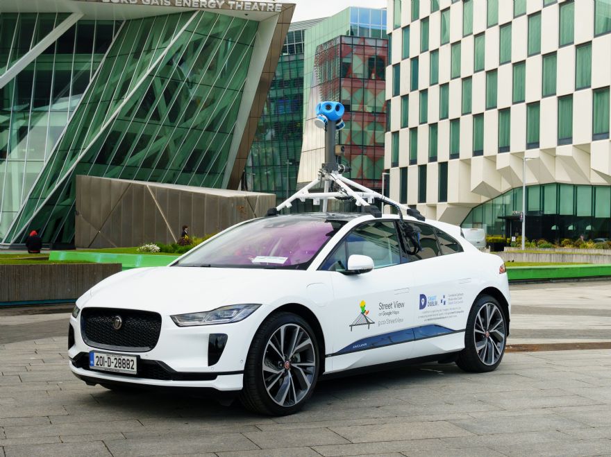
Jaguar Land Rover (JLR) has partnered with Google to integrate the all-electric Jaguar I-PACE with air-quality-measuring sensors and Street View mapping technology.
This is the first all-electric Google vehicle and will be used to measure street-by-street air quality in Dublin, including nitrogen dioxide (NO
2) and carbon dioxide (CO
2) emissions, and fine particles (PM2.5). It will also help update Google Maps.
The Jaguar I-PACE, which offers zero tailpipe-emissions driving, has been equipped with specialised mobile air sensors developed by Aclima and has launched in Dublin to capture data over the next 12 months. Google’s scientific research partners will analyse the data and develop maps of street-level air pollution.
JLR engineers have worked to integrate Google Street View technology into the vehicle,
including new roof mountings for the Street View camera, new rear-window glass which allows for wiring and redesigned interior switchgear to incorporate Google Street View controls.
With a focus on air quality, the I-PACE offers cabin air ionisation and PM2.5 filtration to enhance occupant comfort and well-being.
The partnership comes as JLR defines its future strategy, which includes a commitment to become a ‘net zero’ carbon business by 2039. To realise this vision, JLR will collaborate with industry leaders to enhance sustainability and reduce emissions, as well as sharing best practice in next-generation technology, data and software development.
Elena Allen, JLR’s project manager for business development, said: “The integration of Google Street View technology with the all-electric Jaguar I-PACE is the perfect solution for measuring air quality. We are delighted to support this project as it aligns with our own journey to becoming an electric-first business and achieving ‘net zero’ carbon by 2039.
“Partnerships like this are one of the ways we can achieve our sustainability goals and make a positive impact on society.”
Paddy Flynn, vice president of ‘Geo Operations’ at Google, said: “Air quality is a serious concern, especially for cities, but there is a gap in terms of localised data and insights available to both decision makers and citizens.
“As part of this project, we’re using technology to capture this important data and make it accessible so that, together with Dublin City Council, we can drive solution planning.”