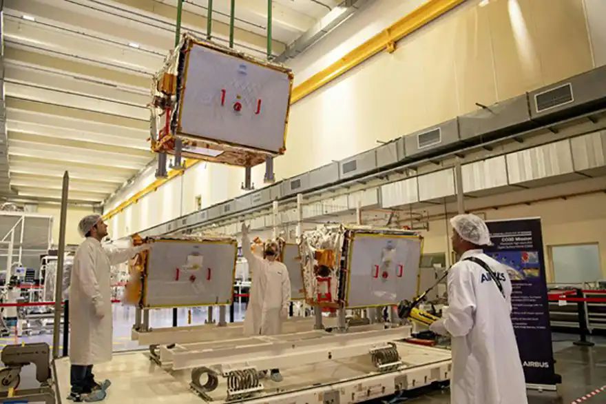
 The four CO3D satellites ready for shipment in Toulouse, France. Photo: Airbus
The four latest-generation optical satellites, developed and built by
Airbus in partnership with the French Space Agency
CNES have been shipped to French Guiana to be launched on a Vega-C rocket on 25 July. Designed and built by Airbus, the CO3D (Constellation Optique 3D) dual-use satellites will deliver a global high-resolution Digital Surface Model (DSM) service to CNES providing 50cm stereo imagery as well as 2-D imagery for government and commercial customers. In addition, the CO3D satellites will strengthen the Airbus range of optical and radar satellites.
Alain Fauré, head of space systems at Airbus, said: “CO3D is not only a step up in operational capability, it is also a game-changer in terms of technological, industrial and commercial innovations. A partnership in French ingenuity, thanks to strong support from CNES, it will further enhance the S250 — our next-generation dual-use optical satellite product that is already attracting particular interest in today’s geo-political context.”
Weighing around 285kg each and equipped with full electric propulsion, the four spacecraft will operate for eight years, in pairs orbiting on opposite sides of the Earth, with the satellites in each pair 100km apart. They will be able to provide stereo imagery from a heliosynchronous orbit at 502km altitude. This data will feed a cloud-based ground segment operated by Airbus, including an image processing chain delivered by CNES, to produce a cutting-edge 3-D map of the Earth’s land mass. This data will answer both the military need for precise and up-to-date cartography as well as civil applications such as hydrology, geology, civil security, urban planning and land and resource management.
Imagery missionsAfter six months of in-orbit testing, the satellites will take 18 months to deliver a 3-D map of France and the ‘crisis arc’ to CNES. Following completion of the mapping service, the satellites will be available for other imagery missions and customers. Innovations and new technologies on the spacecraft include the LASIN, an optical laser communication demonstrator associated with an optical ground station operated by CNES. Installed on one of the four satellites, it will enable download data rates 10-times faster than what is possible with an X-band transmitter, reaching 10 gigabits per sec.
The satellites have been designed to allow customers to upload and execute an application onboard. This can include artificial intelligence (AI) and deep learning applications for the direct detection and extraction of specific items such as vessels or planes. CNES will lead the first demonstration of this new feature.
CO3D will also ‘see in the dark’ thanks to its high-performance sensor equipped with a noise reduction mode. This will enable it to extend the exposure time over a particular target. Combined with an innovative control mode of the satellite, this will unlock image acquisition in low-light conditions to observe dark areas such as urban areas at night.
The CO3D programme, as for subsequent S250-based satellites, benefits from the constellation satellite expertise acquired with the development of the
OneWeb constellation, with standardised equipment, scale effects, strengthened supply chain and optimised production systems, such as design-to-build. The assembly line located in Toulouse was inspired from aeronautics and automotive series production and integrates end-to-end digitalisation of operations and smart tools.
In addition to the new satellites, the carbon monitoring spacecraft Microcarb will also be launched on the same rocket. Microcarb is a joint mission between CNES and the
UK Space Agency and is equipped with a highly capable Airbus-made spectrometer to map the carbon content of the atmosphere at planetary scale, enabling climate scientists and meteorologists to better identify carbon sinks and sources.