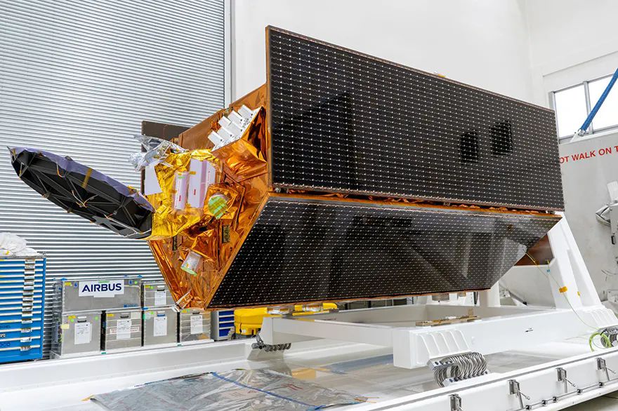
 Airbus-built Sentinel-6B satellite before departing to launch site. Photo: Airbus
The
Airbus-built Sentinel-6B satellite has successfully launched from Vandenberg Space Force Base in California, marking a significant step in global climate monitoring. This is the second of two identical satellites designed to continue collecting essential sea-surface height data until at least 2030. Its predecessor, Sentinel-6 Michael Freilich, was launched in November 2020.
For its first year in orbit, Sentinel-6B will operate alongside Sentinel-6 Michael Freilich, enabling both instruments to collaborate and deliver the most accurate data on global sea levels. These measurements are vital for warning coastal nations of potential hazards and ensuring continuity in ocean weather forecasting.
Alain Fauré, head of Space Systems at Airbus, said: “The launch of this satellite will play a crucial role in advancing ongoing research while building upon the significant progress already achieved. Accurate sea-level measurements are invaluable data to help protect coastal communities and guide global climate action.”
Sentinel-6B will perform high-precision ocean surface topography measurements by transmitting radar pulses to the ocean surface and recording the return time, achieving accuracy within a few centimetres. In addition to monitoring global sea-level rise and ocean circulation, the satellite will gather vertical profiles of atmospheric temperature and humidity.
With sea levels rising at an accelerated pace, Sentinel-6B ensures the continuation of long-term data records essential for shaping climate adaptation and mitigation strategies to prepare for future impacts. This mission is one of more than 20 climate-monitoring initiatives for which Airbus has served as prime contractor, collectively delivering critical insights into the reality of our changing planet.
The satellite operates in a 1,336km non-Sun-synchronous orbit with an inclination of 66deg, allowing it to pass over locations at varying times of day and night to capture changes such as tidal variations. It weighs approximately 1.3 tonnes.
Sentinel-6 is part of the European Union’s Copernicus Programme for environmental monitoring. While a European mission, it exemplifies international cooperation, having been jointly developed by ESA, NASA, EUMETSAT and NOAA, with support from CNES.