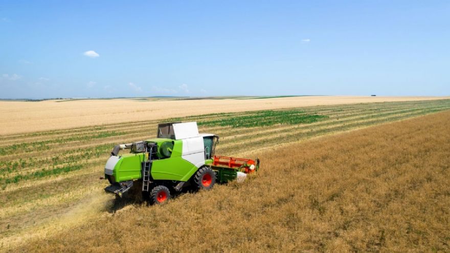
Today, satellite data gives farmers much more than just a weather forecast or yield estimate. It actively dictates how engineers design the onboard computers and physical components of modern tractors and combines. We have moved way beyond relying on a driver's intuition to plow a straight line. Instead, these machines function as highly precise, autonomous hubs, hardwired to steer and apply inputs based entirely on space telemetry.
For instance, John Deere, an American manufacturer of agricultural and forestry machinery, now feeds high-resolution satellite images directly into a tractor's processing unit to improve driving accuracy. This is quickly becoming the baseline standard. Recent agricultural reports indicate that over 60% of new tractors with more than 100 horsepower leave the factory already equipped with satellite guidance hardware. Companies are focused on building ground-level robots that take their orders directly from the sky to execute precise farming.
From Generalized Fields to Custom-fit MachinesA few decades ago, machinery was built for an "average field" without considering the specifics of soil, crops, or weather. Today, engineers are using
high-res satellite images for terrain analysis to map the exact topography of a farm down to the square meter before they even finalise a tractor's chassis.
By pulling optical data from satellites like the European Space Agency’s Sentinel-2, design teams can build precise Digital Elevation Models (DEMs). Instead of building machinery with fixed, static settings, manufacturers are wiring heavy equipment for Variable Rate Technology (VRT). This means the tractor’s onboard computer constantly reads the actual shapes of the land, dynamically adjusting engine torque and hydraulic pressure on the fly to match the reality of the dirt beneath the tires.
Here is exactly how that orbital data dictates mechanical action in the dirt:
•
Predictive Powertrain Control: A tractor’s onboard computer already knows a hill mapped from space and adjusts the transmission and engine RPMs to prevent stalling. Field data indicates this predictive shifting can cut diesel consumption by up to 10%
•
Dynamic Implement Depth: Seed drills automatically adjust their hydraulic down-pressure. As the satellite map indicates a topographical shift from a soft, loamy valley to a hard, rocky ridge, the machine presses harder into the soil to ensure seeds are planted at the exact depth required for germination
•
Gravitational Flow Compensation: Crop sprayers adjust their pump pressure on hillsides so that gravity does not cause chemical over-application on the downhill side of the boom.
The centimetre-level precision revolution: RTK and auto-steer
Driving a tractor today doesn’t require great skills, due to a myriad of digital assistants hardwired into the steering column. For instance, Real-Time Kinematic (RTK) is a technology to achieve 2- to 5-centimetre accuracy in driving. By combining global GNSS data with maps derived from orbit, engineers can lock 20-ton combines onto exact parallel tracks, cutting down on chemical waste and driver fatigue. Here are the benefits:
•
Always-on precision: RTK stays accurate to the centimetre, even in total geographic isolation
•
Remote fixes: Technicians can beam software updates and run engine diagnostics over the air, skipping the costly farm visit
•
Universal hardware: A single satellite antenna works just as well in the American Midwest as it does in South America, eliminating the need to build region-specific cellular modems
When this bulletproof connectivity pairs with the computing power needed to process
high-res imagery right in the field, local infrastructure limits vanish. The modern tractor is no longer an isolated engine; it’s a globally connected precision node.
Smart Implements: From Broadcast to Surgical PrecisionWe have officially moved past the era of "spray and pray" broadcasting, transitioning into an age of surgical application. A prime example of this shift is the Australian weedSAT initiative. By analysing ultra-high-resolution satellite imagery—which achieves pixel sizes as small as 30 centimetres, engineers can train machine-learning algorithms to pinpoint "green-on-brown" weeds scattered across dormant, fallow fields.
This orbital intelligence directly triggers the machine's physical actions in the dirt. Instead of forcing farmers to purchase fragile, boom-mounted optical sensors that routinely cost upward of $250,000, manufacturers can program a conventional boom sprayer to execute a space-derived prescription map. The machine simply activates specific individual nozzles precisely where the weeds exist, slashing herbicide application by up to 80%.
Furthermore, this data-first approach proves that building entirely new machines is not always necessary; we can make ‘dumb’ iron smart. Systems like AgZen’s RealCoverage demonstrate this perfectly:
•
Retrofit Capability: The hardware mounts onto existing sprayers, eliminating the need to purchase brand-new equipment
•
Real-Time Calibration: Using localized AI and the highest quality satellite imagery, mapping out the field context, the system monitors chemical droplet behaviour dynamically, changing pressure and flow on the go
•
Proven Scale: Having already covered nearly one million acres in the United States, this specific integration cuts chemical inputs by 30% to 50% without sacrificing weed kill rates
Predictive Intelligence: Machines That See The FutureManufacturers are designing equipment that actively learns from orbital data to predict field conditions before the header even touches the stalks. John Deere’s Predictive Ground Speed Automation system represents the current benchmark for this technology.
Today's combine harvester basically maps out its own future as it works. By crunching historical crop data and comparing it against live high-resolution satellite images, the machine knows exactly what kind of field conditions are coming before the header even hits the stalks. It sets up a brilliant, continuous feedback loop: the tractor takes the big-picture forecast beamed down from orbit and instantly double-checks those predictions against the actual ground reality using its own onboard cameras.
Space data democratization is the cornerstone of all the “smart” things integrated into agricultural machinery, and the European Space Agency’s Copernicus program acts as a primary catalyst. They can deploy a hundred satellites to capture the Earth's entire landmass every day at 3-5m resolutions in various spectral bands, including a dedicated yellow band engineered to mathematically detect early nitrogen deficiencies.
Conclusion: Engineered From Orbit to AxleSpace is the practical foundation of modern agricultural engineering. Today's farm machinery doesn't work in the dark or in isolation. Instead, the heavy equipment rolling through our fields relies on constant data from high-resolution satellites to know exactly how to operate. From building terrain-driven Variable Rate Technology (VRT) maps to locking in centimetre-perfect RTK steering, the view from orbit literally dictates the mechanics on the ground. By pairing smart predictive algorithms with heavy iron, manufacturers are delivering a much more sustainable and productive way to farm, designed in the sky, but built specifically for the dirt.
To find out more about high-resolution satellite imagery on demand visit:
EOS Data Analytics