 Ocean guardian ready for takeoff: second Copernicus Sentinel-6 satellite heads to launch site.
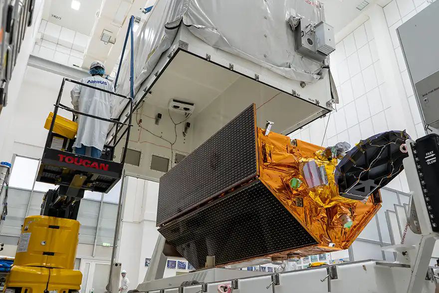
Photo: Airbus Defence and Space GmbHMonitoring of Earth’s rising oceans is about to get a powerful boost following confirmation from
Airbus, the prime contractor for the Copernicus Sentinel-6 missions, that the second satellite in this critical series is on its way to the launch site in Vandenberg, California — lift-off is scheduled for November this year.
Marc Steckling, head of Earth observation, science and space exploration at Airbus Defence and Space, said: “Building on the remarkable success of Copernicus Sentinel-6 Michael Freilich, launched in November 2020, this new Sentinel-6 satellite will ensure the unbroken flow of ultra-precise ocean surface topography data for the next six years. This follow-on mission will meticulously map ocean topography, track sea-level changes with centimetre-level accuracy, and monitor ocean currents, repeating its global survey every 10 days.”
The data delivered by Sentinel-6 is indispensable for understanding and predicting the impact of climate change on our oceans. These precise measurements provide crucial insights into global sea levels, ocean conditions, wind speeds, current dynamics, and heat storage. This information empowers governments and institutions to implement vital protection measures for vulnerable coastal communities and supports applications from urban planning to disaster preparedness.
With global sea levels rising at over 4mm per year, the Sentinel-6 mission, a cornerstone of the European Union’s Copernicus Programme, provides essential intelligence to confront this urgent challenge. This mission is a testament to international collaboration, spearheaded by the
European Space Agency (ESA),
NASA,
EUMETSAT, and the
National Oceanic and Atmospheric Administration (NOAA), with support from
CNES.
Like its predecessor, this 1.5-tonne satellite is equipped with a cutting-edge radar altimeter and an advanced microwave radiometer, continuing a legacy of satellite-based ocean measurements dating back to 1992. For approximately one year after its launch, the two Sentinel-6 satellites will fly in tandem, enabling precise cross-calibration of their data, ensuring unparalleled accuracy and consistency in sea-level monitoring.
Copernicus is the Earth-observation component of the European Union’s Space Programme and provides continuous, free, and reliable Earth observation data and services to public authorities, companies and citizens around the globe. The programme is managed by the European Commission and is co-funded by the EU in partnership with ESA, which is responsible for the coordination, development and implementation, and evolution of the programme, as well as the operations of some spacecrafts.