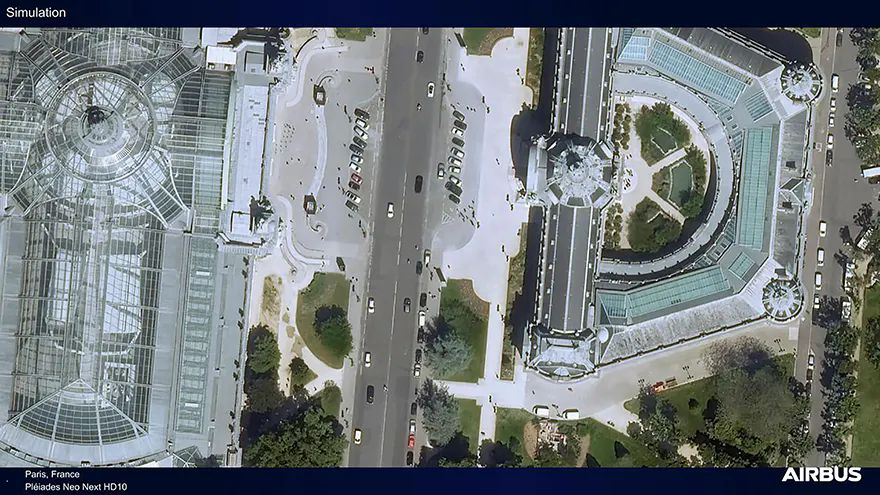
 Paris, France - Simulation of Pléiades Neo Next. Photo courtesy of Airbus Airbus
 is set to strengthen its position in high‑resolution Earth‑observation with the announcement that its first Pléiades Neo Next satellite will be launched in early 2028 aboard an Avio Vega C rocket from the European Spaceport in Kourou, French Guiana. The new spacecraft marks the next stage in Airbus’s optical‑imaging roadmap, delivering 20cm‑class native resolution and enhanced data‑capture performance for professional geospatial users.
The Pléiades Neo Next programme has been conceived to expand and modernise the company’s existing Pléiades Neo constellation, providing improved accuracy, greater imaging capacity and faster tasking‑to‑delivery times across a wide range of industrial, governmental and commercial sectors. It is fully funded, built and operated by Airbus Defence and Space, which intends the new platform to serve markets including defence and intelligence, agriculture, environmental monitoring, maritime operations, disaster response, mapping, location‑based services, civil engineering, urban planning and utilities.
Eric Even, head of space digital at Airbus Defence and Space, said: “The Pléiades Neo Next programme builds on the success of our existing Pléiades Neo constellation which serves government and commercial customers around the world. This programme will further enhance our standard of excellence in terms of quality, performance, and reliability to deliver images as well as geo-intelligence services and applications.”
Time-critical applicationsThe new satellites will continue to support direct tasking by users, who will be able to programme imaging requests only minutes before an overpass of the target area. Data will be delivered either via customer Direct Receiving Stations on the ground or through Airbus’s OneAtlas digital platform shortly after acquisition, ensuring rapid access for time‑critical applications.
Operating alongside the current Pléiades Neo spacecraft, the Pléiades Neo Next units will increase revisit rates to several times per day globally while offering what Airbus describes as the highest spatial resolution and geolocation accuracy available on the market. As part of the programme, Airbus is also upgrading its ground segment, Direct Receiving Stations and the OneAtlas platform to support higher tasking volumes and to minimise the interval between customer request, satellite capture and image delivery.
With the addition of Pléiades Neo Next, Airbus continues to bolster its Earth‑observation portfolio, which combines optical and radar satellites to provide complementary, all‑weather, day‑and‑night imaging capabilities at multiple resolutions. In parallel, the company is also pursuing new sensing approaches built on stratospheric platform technologies.